Travel Guide of Lahaina in United States by Influencers and Travelers
Lahaina is the largest census-designated place in West Maui, Maui County, Hawaii, United States and includes the Kaanapali and Kapalua beach resorts. As of the 2010 census, the CDP had a resident population of 11,704.
Pictures and Stories of Lahaina from Influencers
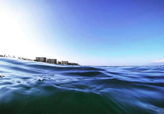
2 pictures of Lahaina from Greg Rakozy, Joe Weller, and other travelers
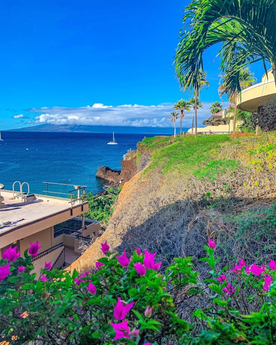
- Marriott hotel overlooking Black Rock Beach, Lahaina, Hawaii. ...click to read more
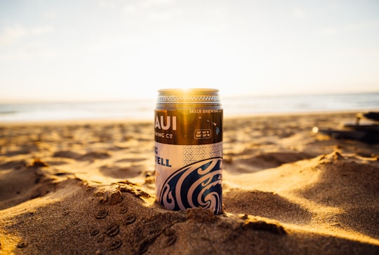
- Experienced by @Joe Weller | ©Unsplash
Plan your trip in Lahaina with AI 🤖 🗺
Roadtrips.ai is a AI powered trip planner that you can use to generate a customized trip itinerary for any destination in United States in just one clickJust write your activities preferences, budget and number of days travelling and our artificial intelligence will do the rest for you
👉 Use the AI Trip Planner
The Best Things to Do and Visit around Lahaina
Disover the best Instagram Spots around Lahaina here
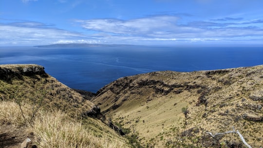
1 - Hawaiian Islands
8 km away
The Hawaiian Islands are an archipelago of eight major islands, several atolls, and numerous smaller islets in the North Pacific Ocean, extending some 1,500 miles from the island of Hawaiʻi in the south to northernmost Kure Atoll.
View on Google Maps Book this experience
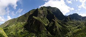
2 - West Maui Mountains
9 km away
The West Maui Mountains, West Maui Volcano, or Mauna Kahālāwai which means "holding house of water," is approximately 1.7 million years old and forms a much eroded shield volcano that constitutes the western quarter of Maui.
View on Google Maps Book this experience
3 - Shore Excursions in Lahaina
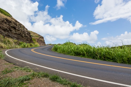
The Hāna Highway is a 64.4-mile long stretch of spectacular views of rainforest, waterfalls, beaches and coastline. On the east after Kalepa Bridge, the highway continues to Kīpahulu on the Piilani Highway. Although Hāna is only about 52 miles from Kahului, it takes about 2.5 hours to drive when no stops are made as the highway is very winding and narrow and passes over 59 bridges, 46 of which are only one lane wide. There are approximately 620 curves along Route 360 from just east of Kahului to Hāna, virtually all of it through lush, tropical rainforest. Many of the concrete and steel bridges date back to 1910 and all but one are still in use. This full-day trip to the Hana coast has the best scenic drive along the shorelines of Maui.
Learn more
4 - Iao Valley
14 km away
Iao Valley is a lush, stream-cut valley in West Maui, Hawaii, located 3.1 miles west of Wailuku. Because of its natural environment and history, it has become a tourist location. It was designated a National Natural Landmark in 1972.
Learn more Book this experience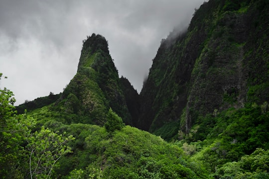
5 - Iao Valley State Park
16 km away
Learn more
6 - Lahaina Pali Trailhead
19 km away
Learn more
7 - Maui
20 km away
The island of Maui is the second-largest of the islands of the state of Hawaii at 727.2 square miles and is the 17th largest island in the United States.
Learn more
8 - Lanai
21 km away
Lanai is the sixth-largest of the Hawaiian Islands and the smallest publicly accessible inhabited island in the chain. It is colloquially known as the Pineapple Island because of its past as an island-wide pineapple plantation.
Learn more
9 - Paia
34 km away
Pā'ia is a census-designated place in Maui County, Hawaii, United States, on the northern coast of the island of Maui. The population was 2,470 at the 2020 census.
Learn more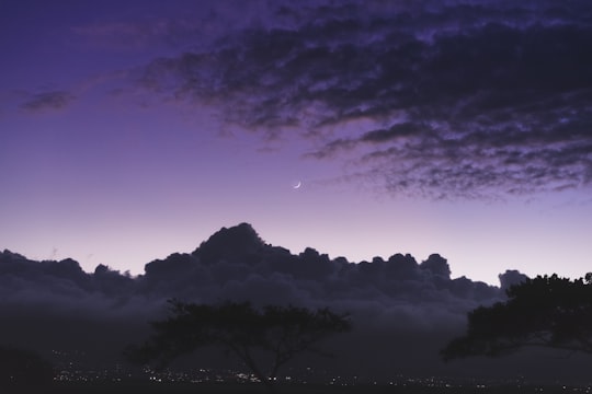
10 - Hookipa Beach
35 km away
Hoʻokipa is a beach on the north shore of Maui, Hawaii, United States, perhaps the most renowned windsurfing site in the world.
Learn more Book this experience
11 - Haiku
38 km away
Haiku-Pauwela is a census-designated place in Maui County, Hawaii, United States. The population was 8,118 at the 2010 census.
Learn more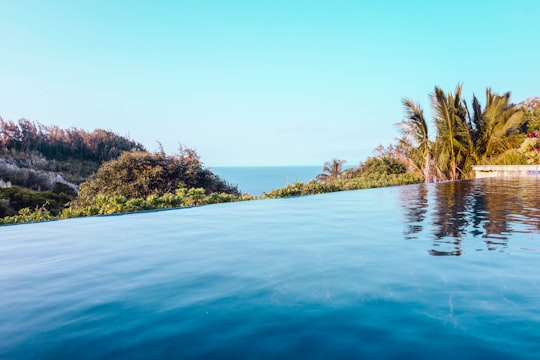
12 - Hana Highway
40 km away
The Hana Highway is a 64.4-mile-long stretch of Hawaii Routes 36 and 360 which connects Kahului to the town of Hana in east Maui. To the east of Kalepa Bridge, the highway continues to Kipahulu as Hawaii Route 31.
Learn more Book this experience
13 - Kula
41 km away
Kula is a district of Maui, Hawaii, that stretches across the "up-country", the western-facing slopes of Haleakalā, from Makawao to Kanaio. Most of the residential areas lie between about 500 to 1,100 m in elevation.
Learn more
14 - Kihei
42 km away
Kihei is a census-designated place in Maui County, Hawaii, United States. The population was 20,881 at the 2010 census.
Learn more
Book Tours and Activities in Lahaina
Discover the best tours and activities around Lahaina, United States and book your travel experience today with our booking partners
Where to Stay near Lahaina
Discover the best hotels around Lahaina, United States and book your stay today with our booking partner booking.com
More Travel spots to explore around Lahaina
Click on the pictures to learn more about the places and to get directions
Discover more travel spots to explore around Lahaina
🌊 Ocean spots 🏖️ Beach spots 🏖️ Coast spots ⛰️ Hill spots 🏞️ Watercourse spotsTravel map of Lahaina
Explore popular touristic places around Lahaina